
Kelowna Parks Challenge – Trip #38
This week, as part of the Kelowna Parks Challenge, I travelled once again to the new neighbourhood of Southridge. There I explored four parks, including the fabulous Kuiper’s Peak Park, located at the top of the community.
Read on for my impressions and reflections.
The Trip
Southridge is located on the south ridge of the canyon formed by Bellevue Creek. It is also sometimes called the Upper Mission, since Okanagan Mission is situated on the valley bottom below. The subdivisions of Southridge have been developed in stages over the past couple of decades, and development isn’t done yet.
The first time I visited Southridge, I explored the northernmost section, nearest to the Mission. That neighbourhood was developed twenty years ago. This week, my adventure took me to the slopes to the south of that, which were subdivided and built-in ten years ago. In an upcoming trip, I will be exploring the Ponds, the neighbourhood to the immediate east, which is currently in the process of being subdivided and built.
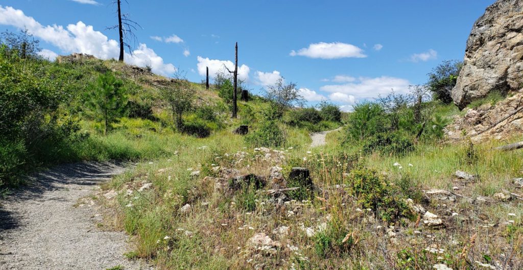
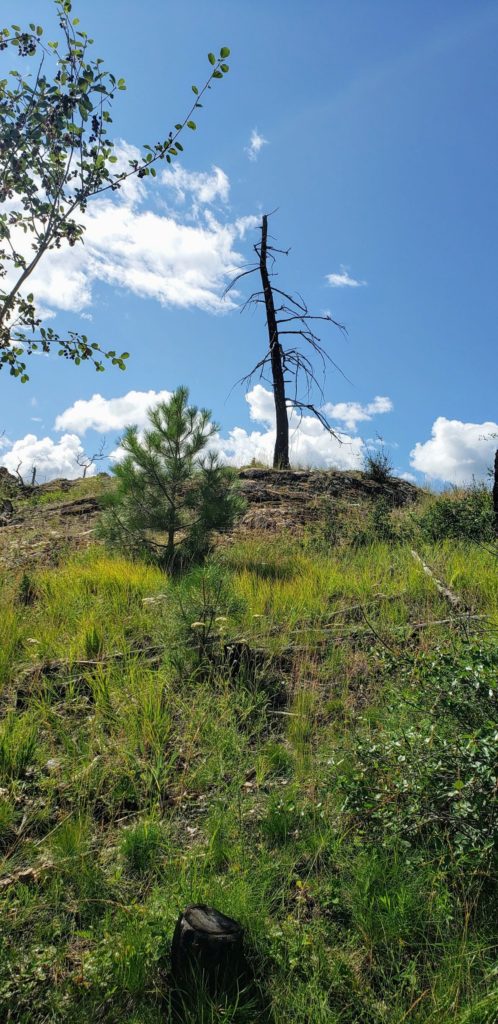
As with the neighbourhood of Kettle Valley, to the west, which I explored earlier this year, Southridge sits on the northern edge of the area burned by the Okanagan Mountain Fire of 2003. Much of the territory I explored this week was burned clear of its forest covering at that time. This was especially evident in Kuiper’s Peak Park, where blackened stumps and fallen trunks still dot the rocky landscape.
Southridge Open Space
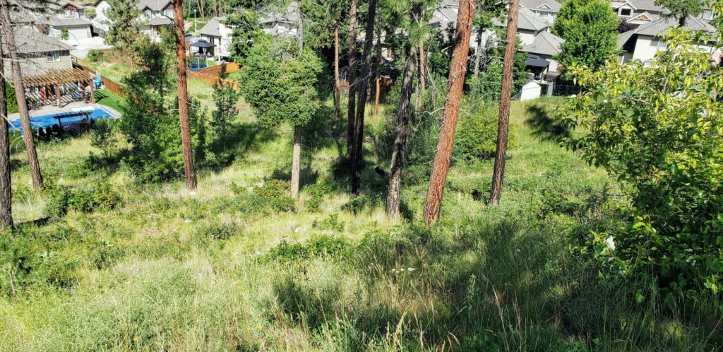
This park is an undeveloped green space. It comprises the steep slope between the houses on Benmore Place and those on Horn Crescent and South Crest Drive. I could find no official or unofficial trails through this park.
Because it is so steep, this park is likely to remain undeveloped for some time. Nevertheless, it provides a great conservation corridor, allowing animals and plant communities a connection between the South Ridge Detention Pond & Open Space to the east and the undeveloped land around Frazer Lake to the west.
Washrooms and Drinking Fountains: There is no drinking fountain in this park. There is no washroom in this park.
Dog Rules: Though this park has no trails, dogs are allowed in this park. They must be on-leash.
Benmore Open Space
This park is another undeveloped green space. It preserves a lovely sloping wood and connects South Ridge Drive to the backyards of houses along Benmore Place and Benmore Court. Given the narrow, direct connection this park makes with Benmore Court, it seems likely an unofficial trail will develop through this park if an official one is not put in.
Once again, this park has no developed features, but exists to provide a conservation corridor connecting the upper slopes of the Southridge neighbourhood with the lower land around Frazer Lake.
Washrooms and Drinking Fountains: There is no drinking fountain in this park. There is no washroom in this park.
Dog Rules: Because this park has no trails, dogs are not allowed in this park.
Clarance Open Space
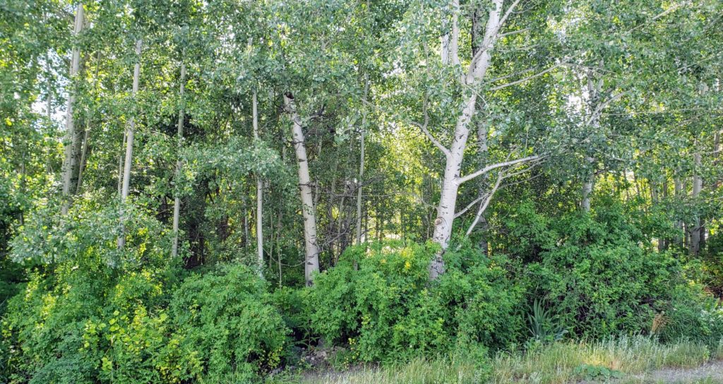
This park is another undeveloped green space, providing important conservation value in this neighbourhood. Occupying a large corner lot, this park preserves a stand of aspen trees, with an understory of wild roses and other shrubs. Considering that the dominant canopy trees in this area are pines and douglas firs, this is a more rare ecosystem.
This park doesn’t connect directly to any other green corridors in the neighbourhood. It also doesn’t have any official or unofficial trails in it. Nevertheless, it provides a valuable reservoir of biodiversity for the Southridge neighbourhood.
Washrooms and Drinking Fountains: There is no drinking fountain in this park. There is no washroom in this park.
Dog Rules: Because this park has no trails, dogs are not allowed in this park.
Kuiper’s Peak Park
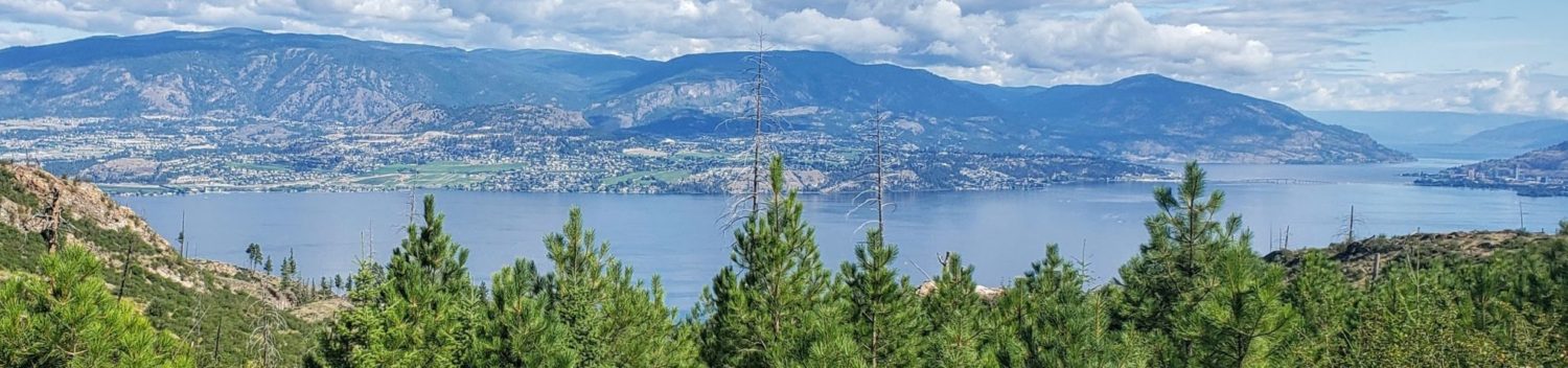
This is a large destination park that preserves the height of land that sits above the entire Southridge neighbourhood. As such, it provides access to an amazing view of the land around it. The peak is as high as Knox Mountain, which one can see far to the north from the summit. A city water reservoir is located in this park, taking advantage of the gravity assist received from the altitude.
This park’s main feature is a well-developed trail that leads from the end of Hewetson Ave up along the ridge to the reservoir, with an ill-marked side trail to the summit. From the reservoir, you can continue west on the utility road to Kuipers Crescent.
Washrooms and Drinking Fountains: There is no drinking fountain in this park. There is no washroom in this park.
Dog Rules: Dogs are allowed in this park. They must stay on the trail and be on a leash.
Reflections
Once again, Southridge offered a chance to explore a more modern, conservation-minded style of subdivision design. By preserving the hillsides between almost every street as conservation corridors, plant and animals communities and the gene pools they compromise can flow freely, giving them a chance at resilience they wouldn’t get in traditional, isolated “island of green” parks. Clarance Open Space seems to have been neglected somewhat in this respect and I can’t help but wonder how its precious ecosystem will hold up over the coming decades.
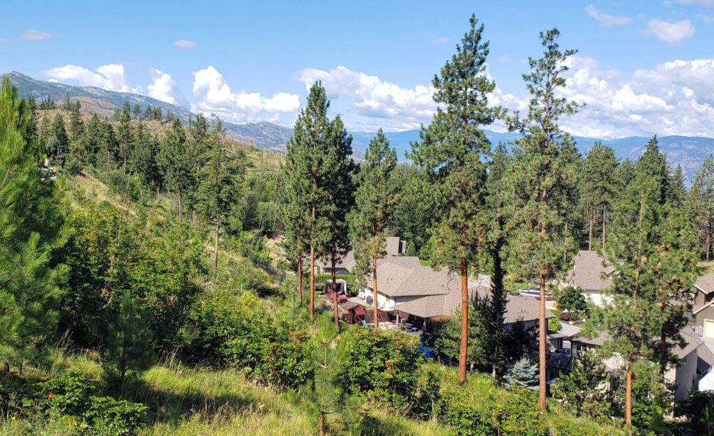
The greatest example of preservation I explored this week was, of course, Kuiper’s Peak Park. Even though I was able to look around it and see green places I know will soon be covered in houses, it is hard to imagine that that development will diminish the wonderful feeling I got rambling over its hills and enjoying its impressive view. Some have seemed to suggest that the 2003 wildfire somehow ruined the landscape of the south slopes, but I saw abundant evidence of regrowth throughout the park, particularly in the form of young pine trees, destined someday to be a new forest canopy.
Land to the south of Kuiper’s Peak
I will be interested over the next years and decades to see what happens with the lands to the south of Kuiper’s Peak. Currently, though they have not been rezoned or subdivided, the large agricultural sections between the park and the Gillard Forest Service Road do lie within the Kelowna city limits and are marked as part of the Permanent Growth Boundary on the city’s online map.
I have read that there is some tension at the moment between development forces, who would like to add more residential density to the area, to bolster the business case for the village centre being built on the commercial zone along Frost Road, between Gordon and Steele Roads, and some members of the city council, who would like to curb hillside sprawl. I can see both sides of that argument and it will be interesting to see how it plays out.
Conclusions
With the addition of this week’s four parks, I have now explored one hundred seventy-one parks in two hundred ninety-seven days, or 84% of the parks in 81% of the days. Four parks doesn’t move me farther ahead, but it doesn’t put me behind either. I know there will be some upcoming weeks with fewer than four parks, so it feels good to have a buffer.
I hope you enjoyed learning about the parks of Southridge. Kuiper’s Peak is a fun little climb and a destination park for anyone who visits Kelowna. I hope you will come back to read about what I see next week.


